


Marine Services
Lay Up Service
Floating Equipment
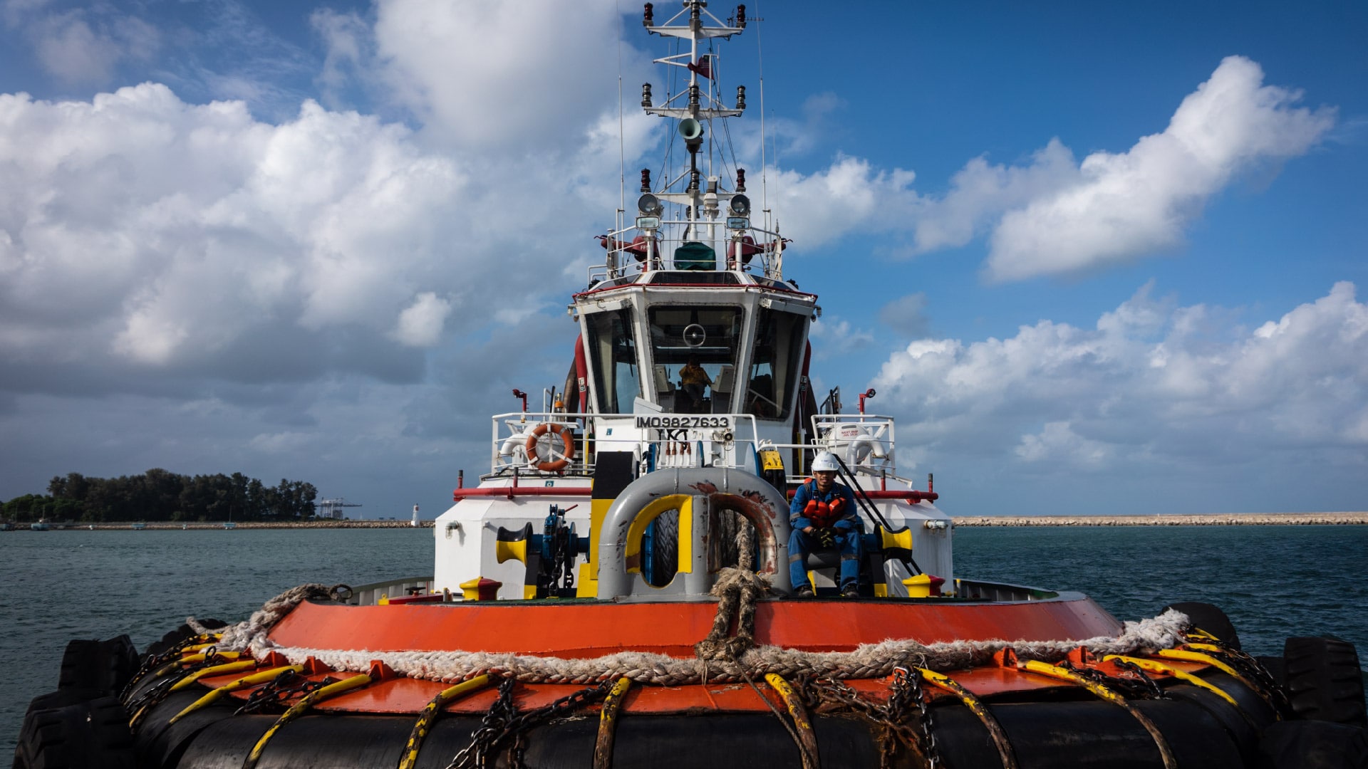
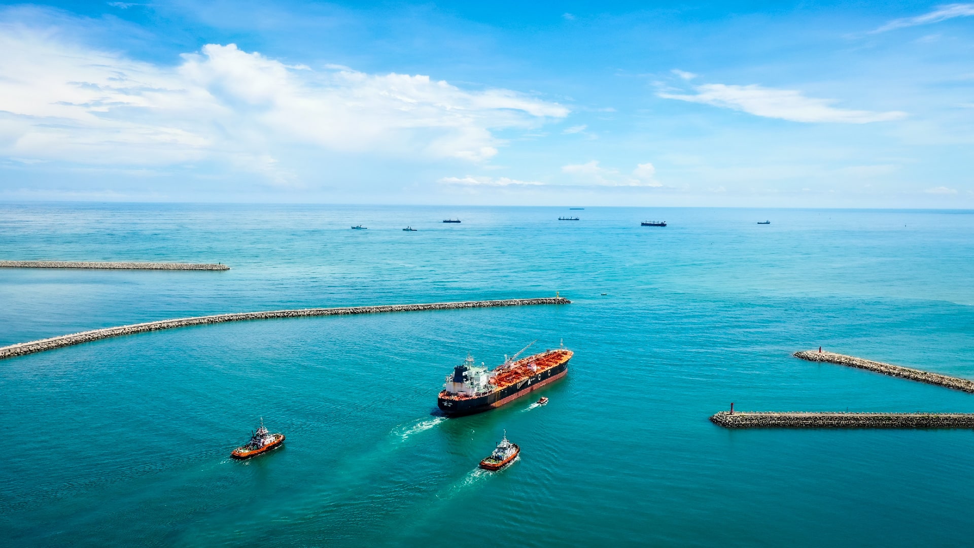
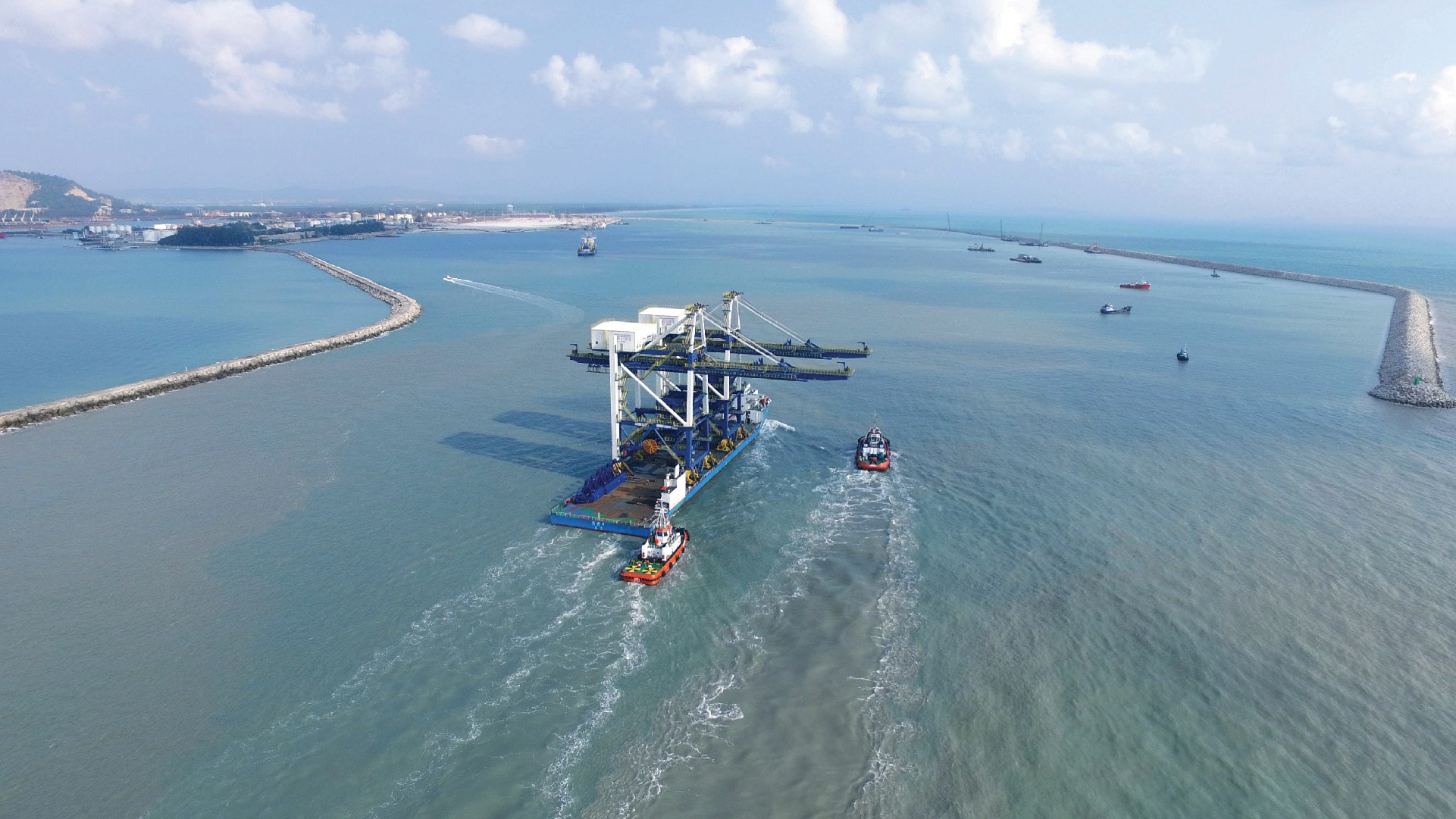
1)Tugboat
Tugboats are necessary services needed by Kuantan Port to carry out the berthing and unberthing operations. All tugboats are fully equipped with firefighting equipment, towing lines, and have the capability to be deployed during oil spill clean-up operations.
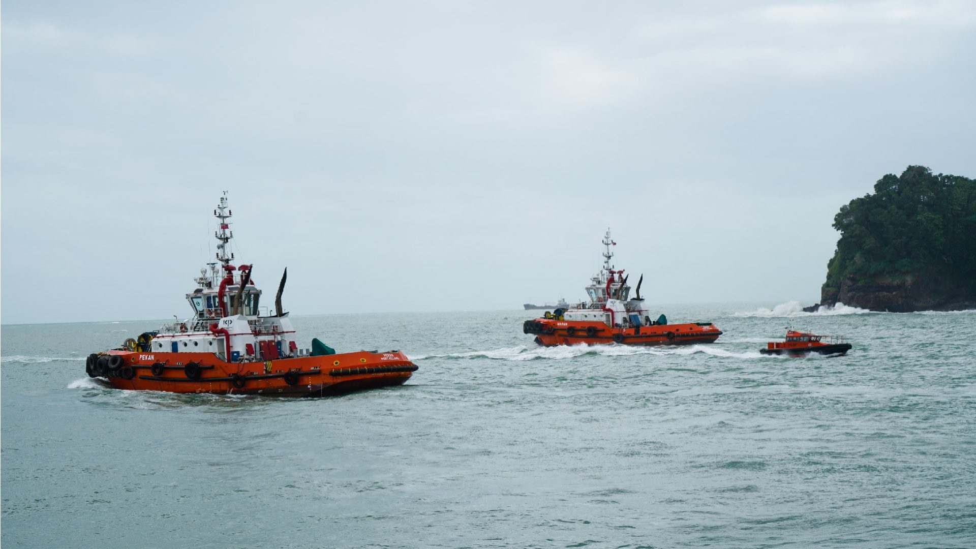
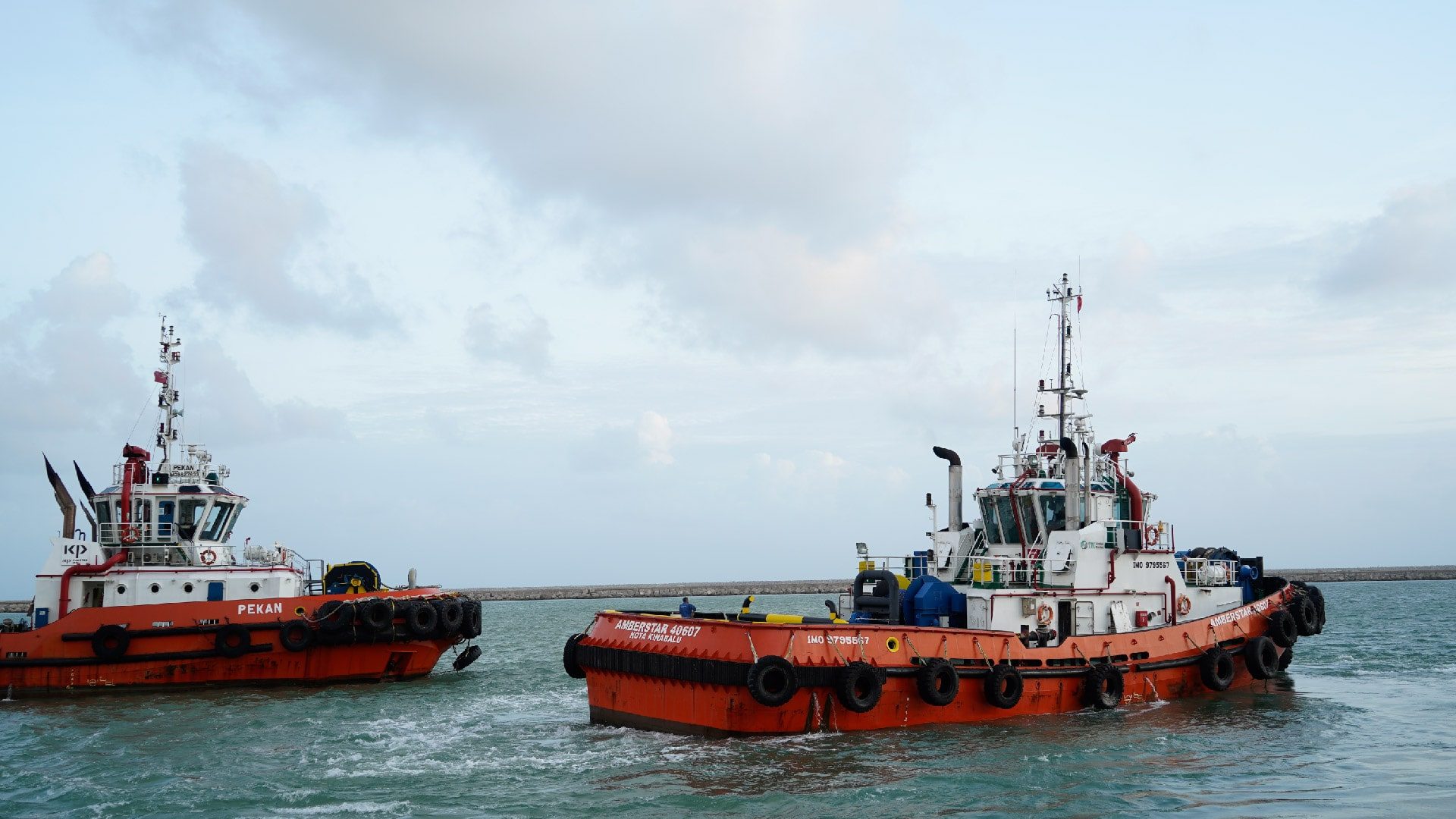
Tugboats in Kuantan Port
MV Pekan & MV Maran
- Bollard pull: 45 tons
Amberstar 07 & Amberstar 08
- Bollard pull: 50 tons
The minimum tug requirement
The minimum number of tugs recommended for each vessel during berthing and unberthing movements is stipulated as follows:
- Vessel less than 225 metre of LOA : 2 tugs
- Vessel 226 metre to 260 metre of LOA : 3 tugs
- Vessel more than 260 metre of LOA : 4 tugs
The pilot can request additional tugs or remove at least one tug depending on the situation assessed by the pilot.
2)Pilot boat
Pilot boat maintains listening on Ch 12 or 16.
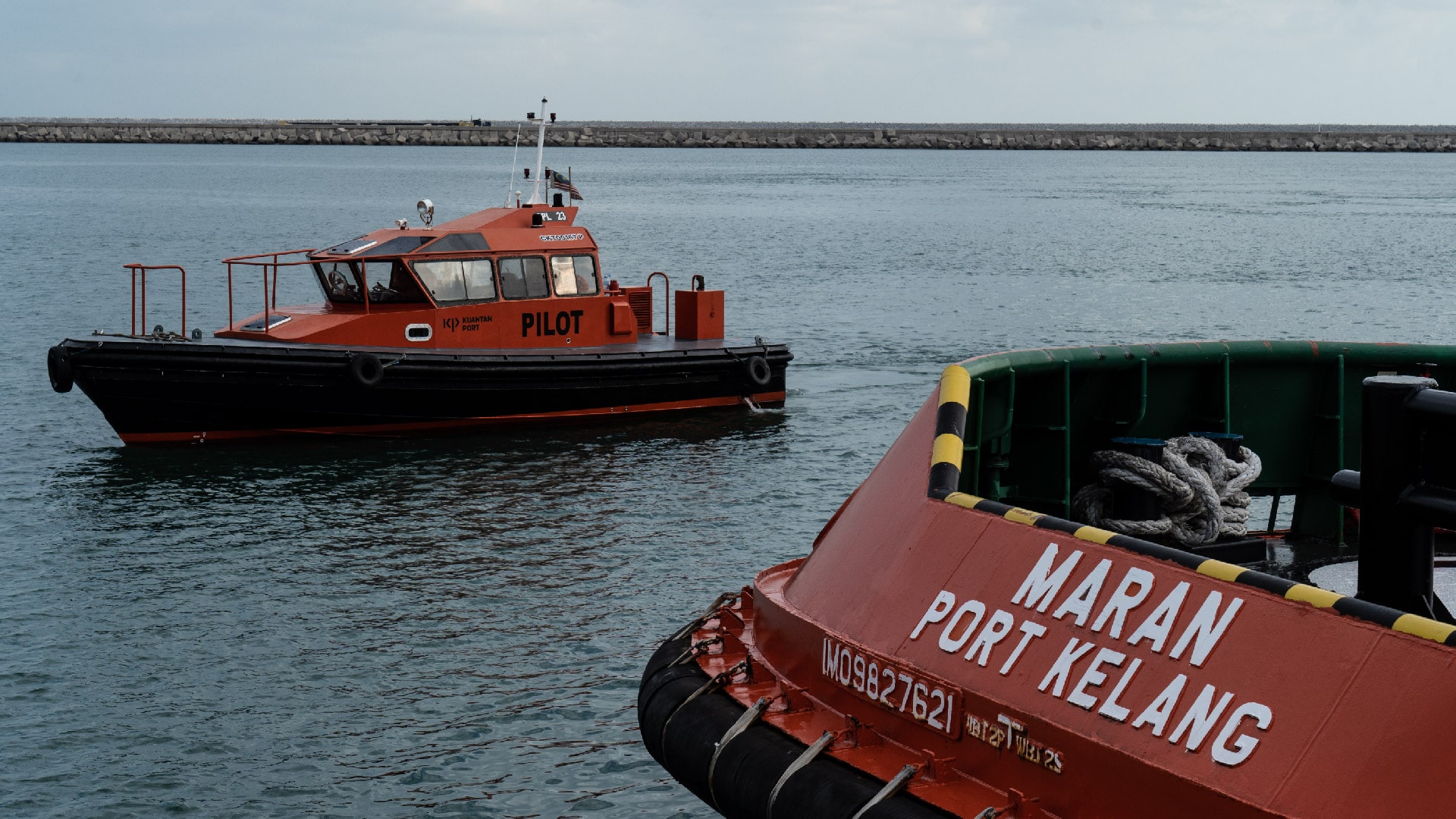
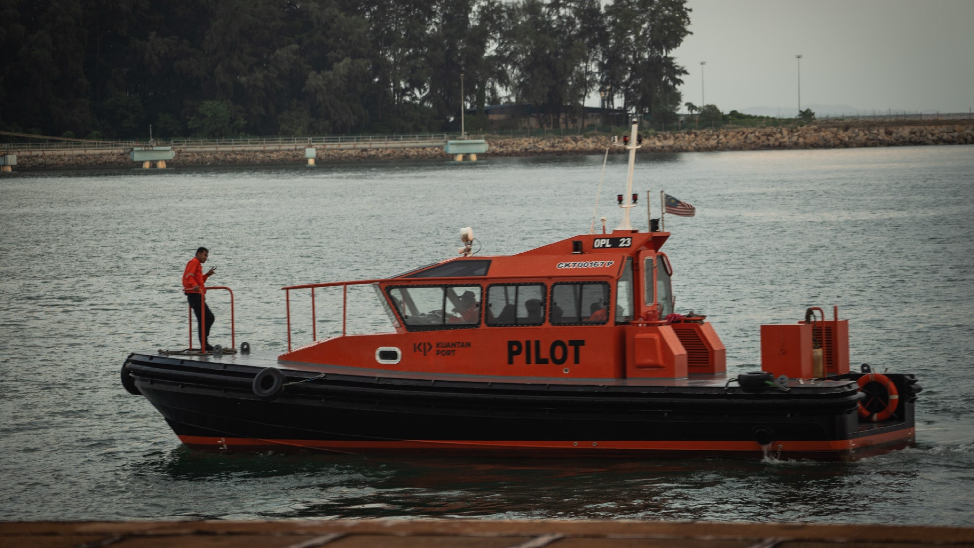
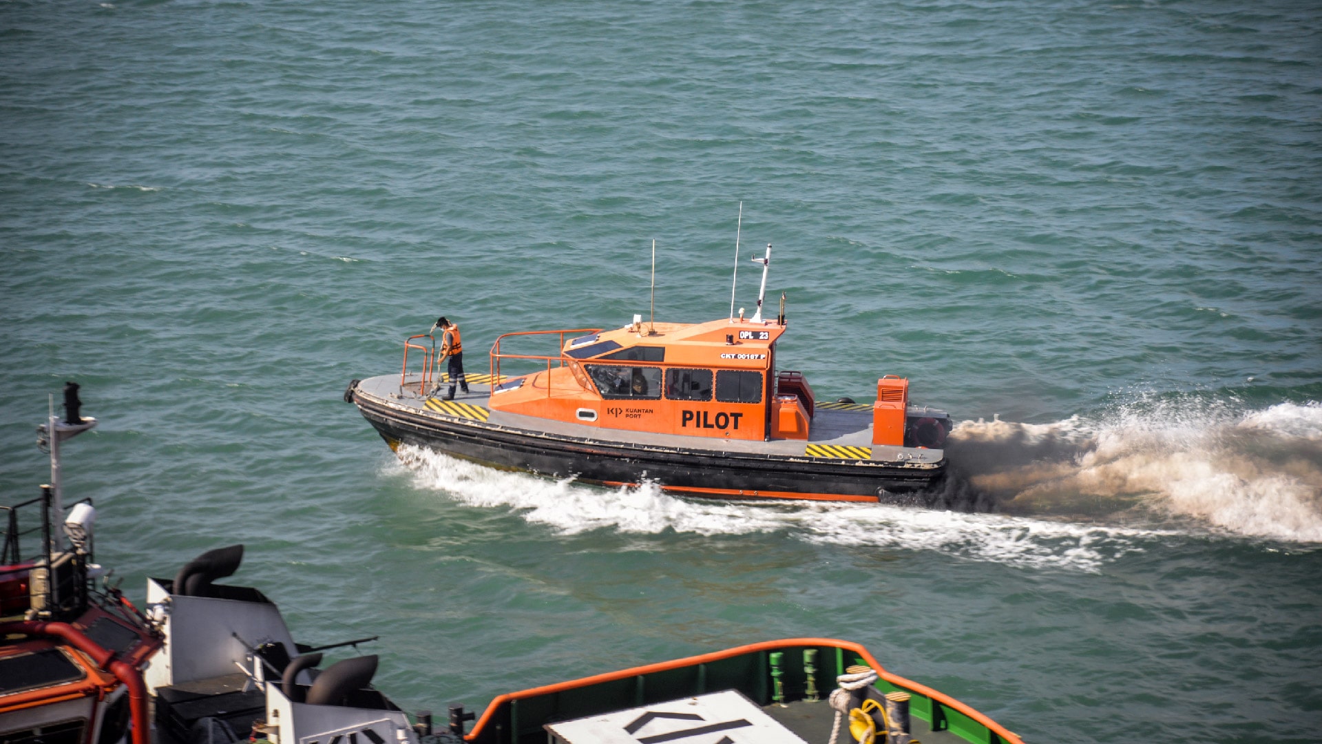
Pilot boat in Kuantan Port
-
OPL Marine 23
Length overall (LOA): 12.0 metre, Width: 4.0 metre - OPL Marine 25 (service boat)
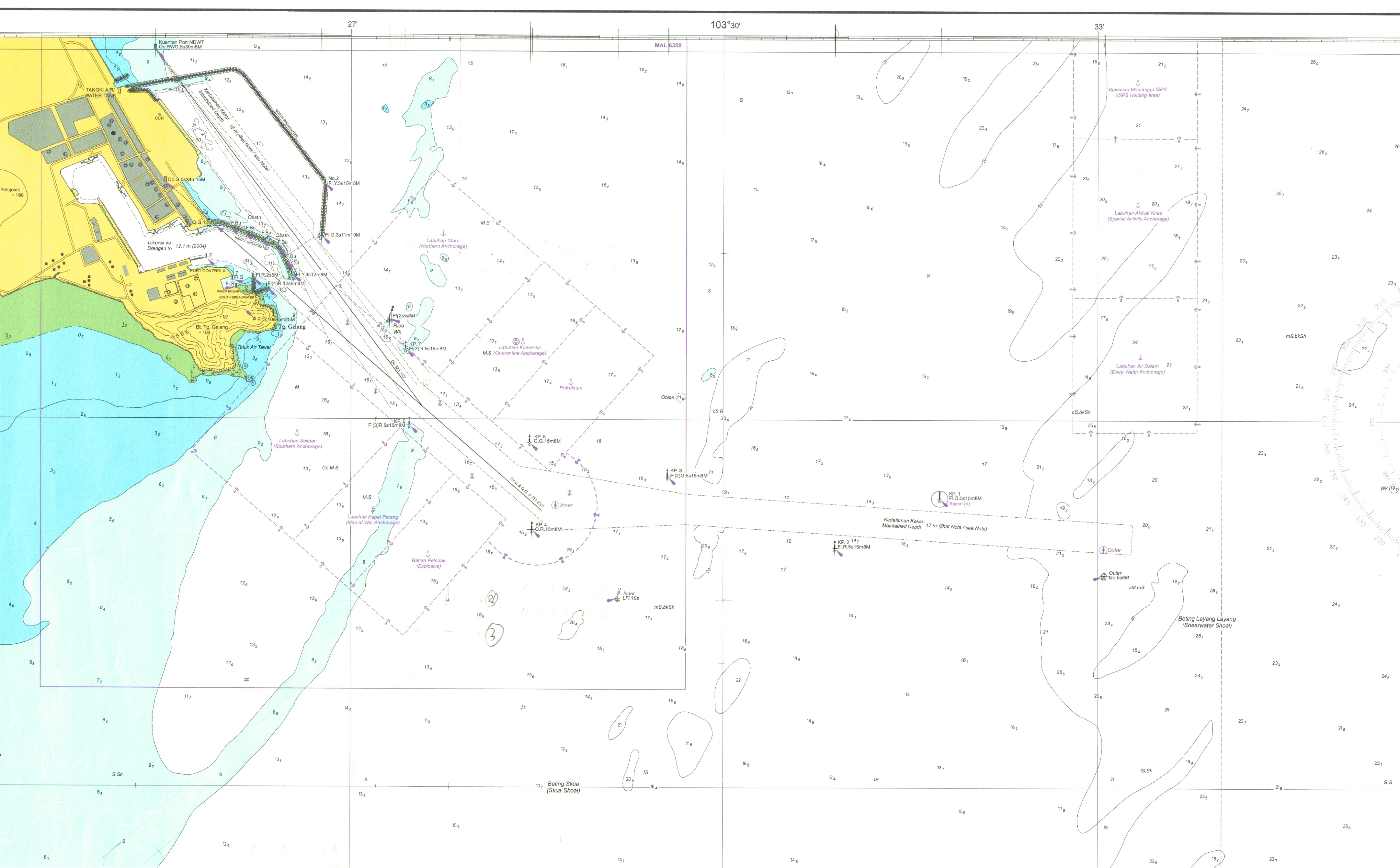
Port Limit
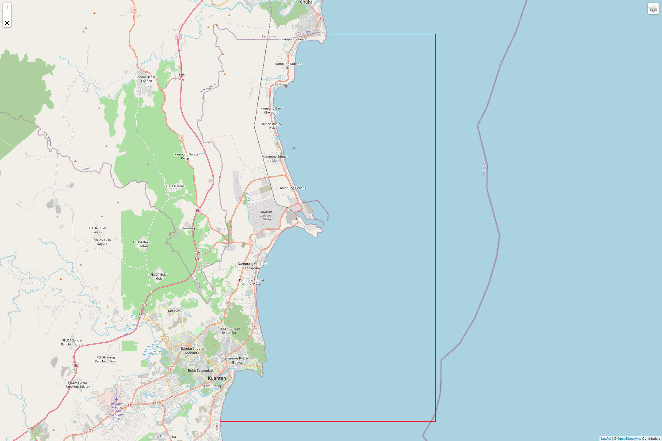
The port limit of Kuantan Port encloses an area of 957 km2 or 279.017 nmi2. This area includes the pilot stations (outer pilot station and inner pilot station), anchorage (northern, quarantine, petroleum, southern, man of war, explosive, deep water, special activity and International Shipping and Port Security (ISPS) holding area), approach channel, berths, wharves and other facilities.
In addition, according to the Merchant Shipping Ordinance (Ordinan Perkapalan Saudagar) 1952 – Kuantan Port Limit (Section 6(3)), Kuantan Port declared the port pilotage area enclosed by the following imaginary lines:
- From a point on the foreshore at Lat. 4°11’ N Long. 103° 27’ E due East to;
- Lat. 4°11’ N Long. 103°34’ thence due South to;
- Lat. 3° 45’ N Long. 103° 34’ E thence due West to; and
- A point on the foreshore at Lat. 3° 45’ N Long. 103° 19’ 34” E, from there, northwards along the foreshore and the southern bank of Sungai Kuantan up to Long. 103° 18’ 30” E and along the 7 above Longitude northwards to the north bank of the river again northwards along the foreshore and back to the position (A) first mentioned; including all piers, jetties, landing places, wharves, quays, docks and other similar works whether within or without the line of high water marks and any positions on the shore or bank within 50 yards of the high water mark subject to any rights of private property therein.”
Anchorage
Anchorage
The anchorage of ships can change depending on the permission from the Marine Department, Kuantan Port Authority and Port of Control. Moreover, it also depends on the LOA and the draft of the vessels, including the availability of the anchorage area itself.
1. Northern Anchorage
Recommended for general purposes (i.e., waiting for berthing) and others. All vessels can anchor (no limit for LOA and draft).
2. Quarantine Anchorage
An anchorage for any ships that are waiting for a pratique (clean bill of health).
3. Petroleum
Any tanker ship that carries petroleum, palm oil, chemicals etc. that is waiting for berthing.
4. Man of War Anchorage
An anchorage for war/military vessels.
5. Explosive
An anchorage for any vessel that carries substance that is highly explosive.
6. Deep Water Anchorage
Anchorage for deep-draft vessels of more than 11.2 metre that intended to enter the New Deep Water Terminal (NDWT).
7. Special Activity Anchorage
Allocated area for activities licensed by Kuantan Port Authority.
8. International Shipping and Port Security (ISPS) Holding Area
Holding area for vessels detained under the ISPS Code.

Channel Radio
Pilot Control Call : Kuantan Port Control
VHF Channel : Channel 12 and Channel 16
Phone: +(6)09-586 3866
Mobile: +(6)019-583 3248

Pilot Station
Pilot Station
The general directions, rules and regulations pertaining to the safety of navigation are in accordance with the Port Authorities Act, Merchant Shipping Ordinance, Kuantan Port Authority, Kuantan Port, Pilotage By-Laws, International Regulations for Prevention of Collisions at Sea 1972, IALA Buoyage System A and the Marine Department. All these bodies work together within their jurisdiction to ensure the safety of navigation, as well as all activities within the port.
Kuantan Port can be approached via the inner and outer pilot station.
Inner Pilot Station
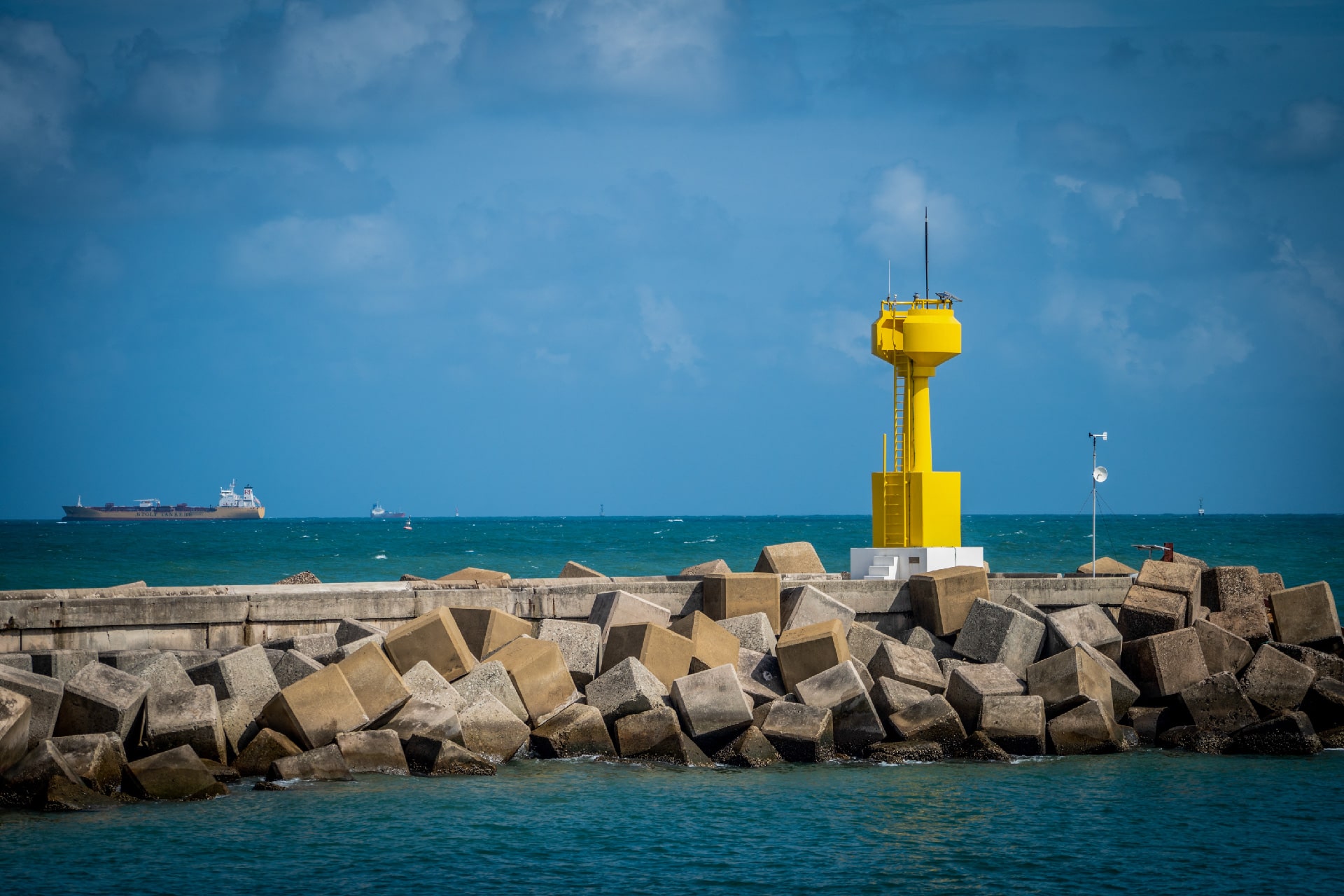
The inner pilot station lies at the coordinate of Lat. 3° 56.3’ N Long. 103° 28.3’ E. This pilot boarding ground is made for vessels with draft of less than 12.0 m entering the facilities at southern basin of Kuantan Port. This pilot station is marked by a fairway buoy lat. 3° 55.6’ N long. 103° 29.2’ E.
Outer Pilot Station
The outer pilot station lies at the coordinate of Lat. 3° 55.9’ N Long. 103° 33.0’ E. This pilot boarding ground is made for deep draft vessels with draft of more than 12.0 m entering facilities at northern basin, the Deep Water Terminal. This pilot station is marked by a fairway buoy lat. 3° 55.8’N long 103° 33.0’ E.
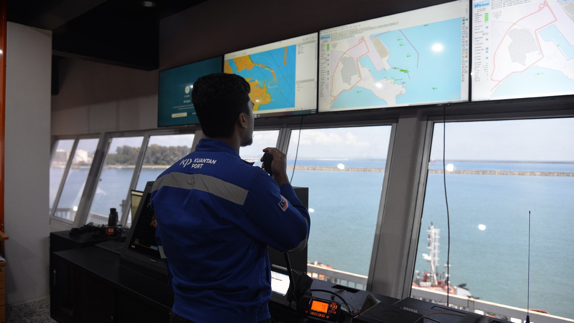
VTMIS
VTMIS
The anchorage of ships can change depending on the permission from the Marine Department, Kuantan Port Authority and Port of Control. Moreover, it also depends on the LOA and the draft of the vessels, including the availability of the anchorage area itself.
Channel Depth
Dredged channel
| Channel | Depth | |
| KP1 | KP2 | |
| Approach channel | 17.0 m | 17.0 m |
| Basin | 12.1 m | 16.0 m |
| Berth Pocket | – | 18.0 m |
Launch Boat
Launch Boat
The launch boat operates upon request by port users at Kuantan Port to carry out any required services. Launch boat maintains listening on Ch 12 or 16.
Launch boat in Kuantan Port
-
OPL Marine 25
Length overall (LOA): 12.0 metre, Width: 4.0 metre - Requests can be made via the MTOS system or by cash payment at the office of Marine Services.
- Capacity up to 12 passengers
-
OPL Marine 25
Length overall (LOA): 12.0 metre, Width: 4.0 metre -
Requests can be made via the MTOS system or
by cash payment at the office of Marine Services. - Capacity up to 12 passengers
